Time for an adventure!
Forum rules
Be kind. No government, state, or local politics allowed. Admin has final decision for any/all removed posts.
Be kind. No government, state, or local politics allowed. Admin has final decision for any/all removed posts.
-
oldbandnerd
- 5 valves

- Posts: 1031
- Joined: Wed Dec 22, 2004 8:43 pm
- Location: No matter where you go... there you are .
- Contact:

-
Brassdad

- 4 valves

- Posts: 997
- Joined: Wed Apr 06, 2005 4:22 pm
- Location: Milford, Ohio
Not only that....they grow straight up and get over 4 feet tall!schlepporello wrote:That's something to keep in mind though.bloke wrote:You won't-at-all have time to do this, but (once in TN) travelling via US-64 the whole way is quite scenic/historic.
By the way, I hear Tennessee has these things that grow out of the ground called "trees". We ain't got none o'them thangs here.
New Breed, Old Breed! It doesn't matter so long as it's the Marine Breed!
-
lgb&dtuba
- 4 valves
- Posts: 886
- Joined: Wed Oct 19, 2005 7:55 am
Old US 64 certainly used to go through all the county seats, but in many places newer sections of 64 no longer do that.
In particular, when I go to the Outer Banks I'd take I-540 east at Durham to US 64 East on the other side of Raleigh, bypassing Raleigh altogether. The newest section of I-540 that makes this possible just opened up this year. US 64 is pretty much 4 lane 65 mph to Williamston now. That cuts about an hour and a half off the trip between Durham and Manteo.
In particular, when I go to the Outer Banks I'd take I-540 east at Durham to US 64 East on the other side of Raleigh, bypassing Raleigh altogether. The newest section of I-540 that makes this possible just opened up this year. US 64 is pretty much 4 lane 65 mph to Williamston now. That cuts about an hour and a half off the trip between Durham and Manteo.
-
LoyalTubist
- 6 valves

- Posts: 2648
- Joined: Sun Jan 29, 2006 8:49 pm
- Location: Arcadia, CA
- Contact:
I will stick to Route 66. I have taken several trips on the Mother Road. Of course, purists would say I do the highway BACKWARDS because I drive it from California to Illinois!
Former US 66 through California...
Santa Monica
West Hollywood
Los Angeles (Hollywood, Silver Lake, Chinatown, Atwater Village, Highland Park)
South Pasadena
Pasadena
Arcadia
Monrovia
Duarte
Irwindale
Azusa
Glendora
San Dimas
La Verne
Pomona
Claremont
Upland
Rancho Cucamonga (Cucamonga, Etiwanda)
Fontana
Rialto
San Bernardino
Devore
Cajon Pass
Hesperia
Apple Valley
Victorville
Oro Grande
Silverlake
Helendale
Hodge
Lenwood
Barstow
Daggett
Newberry Springs
Ludlow
Amboy
Bagdad
Cadiz
Danby
Essex
Fenner
Goffs
Needles
---------------------------
I might not have the places between Barstow and Needles right--this was from memory.
________________________________________________________
You only have one chance to make a first impression. Don't blow it.
You only have one chance to make a first impression. Don't blow it.
-
Rick Denney

- Resident Genius
- Posts: 6650
- Joined: Mon Mar 22, 2004 1:18 am
- Contact:
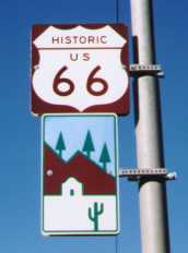
U.S. 66 doesn't exist any more. East of Needles, you'll detour south of the mountains instead of taking the original route through Oatman. And I'll bet you've never seen the town strip in Glen Rio, Texas, or driven up the steepness of La Bajada Hill north of Albuquerque. There is still a stretch of the original 20 feet of portland-cement concrete pavement west of Shamrock, Texas. I'm sure that Schlep knows these spots, however (well, except for La Bajada Hill, which is now an unpaved jeep trail).LoyalTubist wrote:I will stick to Route 66. I have taken several trips on the Mother Road. Of course, purists would say I do the highway BACKWARDS because I drive it from California to Illinois!
It's just Interstate now.
Rick "who directed the removal of U.S. 66 signing in Texas--in 1983" Denney
-
LoyalTubist
- 6 valves
- Posts: 2648
- Joined: Sun Jan 29, 2006 8:49 pm
- Location: Arcadia, CA
- Contact:
Ah, Rick... You are so utilitarian!Rick Denney wrote: U.S. 66 doesn't exist any more...
It's just Interstate now.
I am a member of several Route 66 clubs and have a subscription to Route 66 Magazine.
While the Federal and local designations of Highway 66 may be deleted, the states of California, Arizona, Oklahoma, and Kansas still designate a small portion of the old Mother Road as State Route 66.
And part of the old road serves an important function: On one trip I took, during Memorial Day Weekend in 2003, there was a terrible accident on I-40 at the Essex exit in California. The freeway was completely stopped. All traffic was diverted onto the old highway.
For the towns bypassed by the freeway, be it I-10, I-210, I-15, I-40, I-44, or I-55, the historical recollections of Route 66 are resulting in a profitable tourism business. Take Williams, Arizona, for example. It was the last city missed when I-40 was finished. The people in Williams have pride in their city and, if you stay there during the summer, you will meet people from all over the world.
Yeah, I know Route 66 doesn't exist. But you can still travel on much of it!
Oh, on my list of places in California, between Santa Monica and West Hollywood, there should be:
Los Angeles (West Los Angeles)
Beverly Hills
How could I forget Beverly Hills? I can't afford to park there!
________________________________________________________
You only have one chance to make a first impression. Don't blow it.
You only have one chance to make a first impression. Don't blow it.
-
Rick Denney
- Resident Genius
- Posts: 6650
- Joined: Mon Mar 22, 2004 1:18 am
- Contact:
No, that's not La Bajada Hill. La Bajada is closer to the current I-25. In the old days, U.S. 66 entered Albuquerque on West Central, and then tracked northeast to Santa Fe, and then along (I think) what is now U.S. 84 back to the current I-40 route.schlepporello wrote:Wayne (who's been up the steep grade east of Albuquerque) Wiley
La Bajada Hill is just north of the Zia Reservation, about 3 miles north of Exit 264 on I-25, where NM 16 goes up into the Cochiti Reservation. The road is no longer on street maps--you have to know where it is or look on USGS maps. Last time I drove it, I was in a Jeep Cherokee, and we crawled around large boulders that had fallen onto the road. Once we got to the top of the hill (really, the top of the mesa), the road reappeared, and that part of it still seems to be on maps. When it was U.S. 66, it was common for people to drive up the hill in reverse to take advantage of the lower gear. That wasn't so long ago (1940's), and in those days it was the only road between Albuquerque and Santa Fe.
It's a little easier to follow the old alignment (and this one is at least two generations old--even U.S. 66 was routed off it before I-40 was built) thorugh Oatman, Az. It's now Arizona 10, and it goes over Sitgreaves Pass, west of Kingman and northeast of Needles. The newer U.S. 66 and I-40 routes bypass those mountains to the south. Oatman is the site of an ancient gold mine, and is not a ghost town. The old highway pavement is still intact, and parts of it are 20 feet of portland-cement concrete.
I like following the old routes. Driving on I-40 may follow the same general path, but it ain't the same.
Rick "who lives on and near roads laid out 250 years ago" Denney
-
djwesp
- 5 valves
- Posts: 1166
- Joined: Sat Nov 27, 2004 11:01 pm
You know schlep, my favorite drive is from Amarillo is to Denver, via 385, 87, 64.schlepporello wrote:I experienced that when I drove for an electrical utility supply distributorship. I delivered all over New Mexico, southwest Kansas, the Oklahoma panhandle, lower Colorado, the Texas panhandle, and the eastern edge of Arizona. It came time for vacation and I was perplexed. Where would I go? I was just there last week.bloke wrote:Now we have a professional driver who, during his time off, will spend his vacation...
...DRIVING...??
That's beautiful, especially right at New Mexico. Capulin Mountain?
Probably not the best ride in a big truck, i'm sure you'd probably go thru Ok panhandle?
-
LoyalTubist
- 6 valves
- Posts: 2648
- Joined: Sun Jan 29, 2006 8:49 pm
- Location: Arcadia, CA
- Contact:
Me, me! I will!bloke wrote:I think we've tapped into a new suddenly-favorite TubeNet topic:
geography
Who will admit to having ROAD MAPS sitting on their toilet tank and on the night stand beside their bed?

________________________________________________________
You only have one chance to make a first impression. Don't blow it.
You only have one chance to make a first impression. Don't blow it.
-
tubatooter1940
- 6 valves
- Posts: 2530
- Joined: Mon Mar 22, 2004 11:09 pm
- Location: alabama gulf coast
-
Rick Denney
- Resident Genius
- Posts: 6650
- Joined: Mon Mar 22, 2004 1:18 am
- Contact:
During summer trips to Colorado Springs from Houston, aboard a chartered highway bus, we always took that route. We'd leave Houston in the afternoon, drive all night, and have breakfast in Clarendon, north of Amarillo. We'd get to Colorado Springs that afternoon, and that would include a stop at the pullout next to Capulin Peak so that we Houstonians, whose experience with hills is limited to highway overpasses, could appreciate a real volcanic plug.djwesp wrote:You know schlep, my favorite drive is from Amarillo is to Denver, via 385, 87, 64.
Rick "who doesn't recall any difficulties with the highway bus" Denney
-
Rick Denney
- Resident Genius
- Posts: 6650
- Joined: Mon Mar 22, 2004 1:18 am
- Contact:
-
oldbandnerd
- 5 valves
- Posts: 1031
- Joined: Wed Dec 22, 2004 8:43 pm
- Location: No matter where you go... there you are .
- Contact:
-
TubaRay
- 6 valves
- Posts: 4109
- Joined: Mon Mar 22, 2004 4:24 pm
- Location: San Antonio, Texas
- Contact:
Time for an adventure
Have a great trip. Sounds like one I'd like to take, as well.
Ray Grim
The TubaMeisters
San Antonio, Tx.
The TubaMeisters
San Antonio, Tx.
-
Jack Denniston
- bugler

- Posts: 152
- Joined: Sat Mar 20, 2004 6:32 pm
- Location: Chapel Hill, NC
We've lived in Chapel Hill NC for about 10 years and have really enjoyed both the mountains and the ocean. If you come across on I-40, you'll go right past Great Smoky National Park. Unless you like tourist traps, I'd suggest you avoid Gatlenburg. If you go a little farther east, there are some nice places to get off the interstate, see some beautiful scenery and go for a hike in the park, if you like. Then when you get to Asheville there are some fun spots there. And I'd highly recommend at least a short drive on the BlueRidge Parkway. If you want, you can take it from Asheville up to Boone, then go straight east to Winston Salem. It'll take you a couple hours longer, but the scenery is fantastic (unless there are low clouds, in which case you'll just be looking at the inside of clouds).
Over on the coast, our favorite spot is the National Seashore which starts at Nags Head and runs south about 70 miles. The ferry rides are free and a fun way to get around. Last time we were there, we found a spot where the dolphins were swimming along the shore about 100 yards out- a beautiful sight!
Enjoy!
-
Steve Inman

- 4 valves
- Posts: 804
- Joined: Fri Mar 19, 2004 11:48 am
I think that bridge ended in Kokomo. One of many "firsts" for the "City of Firsts" (really!) (er... "really" about the name of the city, not the bridge .....)schlepporello wrote:There's an effort currently going on to rebuild/restore the natural land bridge that once connected Ireland to central Indiana. Once this is completed the draining will resume and will result in exposing the black hole in the center of the Bermuda Triangle. THEN world dominance will be mine!bloke wrote:It's only been 35 years since my last visit there, so I'm sure nothing's changed (as spoken with tongue in cheek).
I heard they tried to drain the Ocean, but the Polar caps are melting and refilling it faster than they can drain it.
Steve Inman
Yamaha YEB-381 Eb
Conn 56J CC
Willson-Marzan CC Solo Model
Kokomo Chamber Brass
Yamaha YEB-381 Eb
Conn 56J CC
Willson-Marzan CC Solo Model
Kokomo Chamber Brass
-
oldbandnerd
- 5 valves
- Posts: 1031
- Joined: Wed Dec 22, 2004 8:43 pm
- Location: No matter where you go... there you are .
- Contact:
-
dwaskew
- pro musician

- Posts: 429
- Joined: Fri Mar 19, 2004 8:10 am
- Location: Greensboro, NC
- Contact:
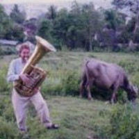
It was great to meet the one and only Schlep---I was in the midst of driving my kids around for their activities and only had a brief time to meet with him and his lovely wife, but we had a great time just talking for a while. Schlep really is that tall, and though you can't tell it from that picture, I'm 6'6", so that puts him well over 8 feet!
have a safe trip home!
dwa
have a safe trip home!
dwa